
File list
More actions
This special page shows all uploaded files.
| Date | Name | Thumbnail | Size | User | Description | Versions |
|---|---|---|---|---|---|---|
| 21:33, 4 October 2016 | 1886-Livia.jpg (file) |  |
25 KB | Adam (talk | contribs) | 1886 Directory Listing for Livia | 1 |
| 21:24, 4 October 2016 | 1886-Habit.jpg (file) |  |
42 KB | Adam (talk | contribs) | 1886 Directory Listing for Habit | 1 |
| 21:23, 4 October 2016 | 1886-Grissoms-landing.jpg (file) |  |
58 KB | Adam (talk | contribs) | 1886 Directory Listing for Grissom's Landing | 1 |
| 21:22, 4 October 2016 | 1886-Gatewood.jpg (file) |  |
44 KB | Adam (talk | contribs) | 1886 Directory Listing for Gatewood | 1 |
| 21:21, 4 October 2016 | 1886-Ensor.jpg (file) |  |
16 KB | Adam (talk | contribs) | 1886 Directory Listing for Ensor | 1 |
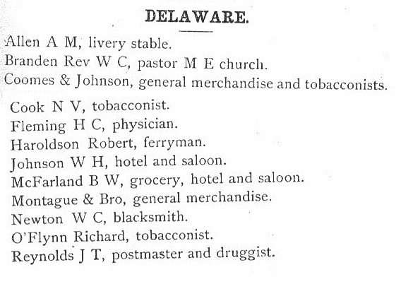
| 21:21, 4 October 2016 | 1886-Delaware.jpg (file) |  |
74 KB | Adam (talk | contribs) | 1886 Directory Listing for Delware | 1 |
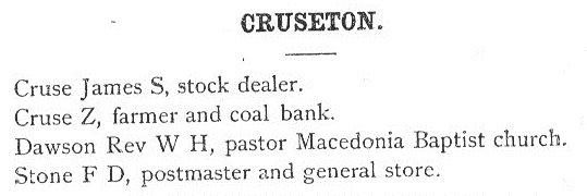
| 21:20, 4 October 2016 | 1886-Cruseton.jpg (file) |  |
31 KB | Adam (talk | contribs) | 1886 Directory Listing for Cruseton | 1 |
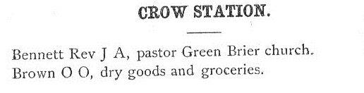
| 21:20, 4 October 2016 | 1886-Crow-station.jpg (file) | 20 KB | Adam (talk | contribs) | 1886 Directory Listing for Crow Station | 1 | |
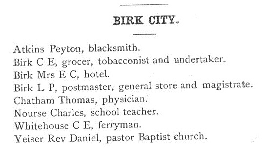
| 21:20, 4 October 2016 | 1886-Birk-City.jpg (file) |  |
51 KB | Adam (talk | contribs) | 1886 Directory Listing for Birk City | 1 |
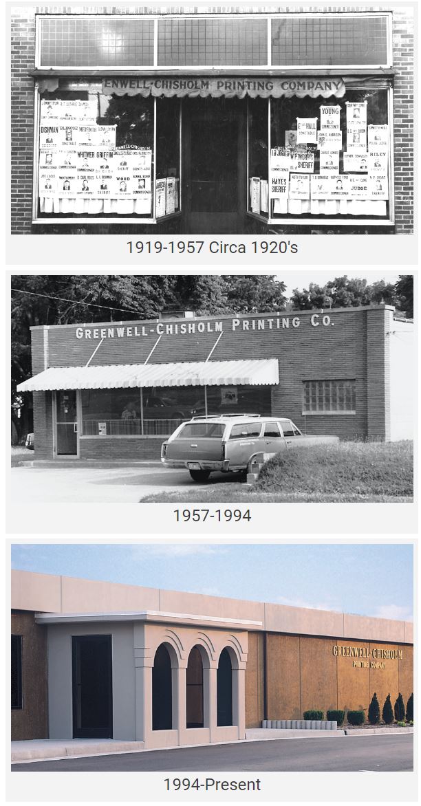
| 14:02, 2 October 2016 | Greenwell Chisholm Buildings.jpg (file) |  |
130 KB | Adam (talk | contribs) | Greenwell Chisholm's locations over the years. | 1 |
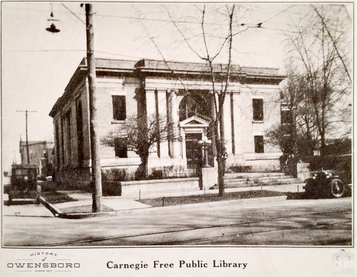
| 02:37, 2 October 2016 | CarnegieFreePublicLibrary.jpg (file) |  |
216 KB | Adam (talk | contribs) | Carnegie Free Public Library located on the SW corner of 9th and Frederica St. | 1 |
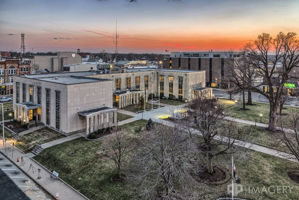
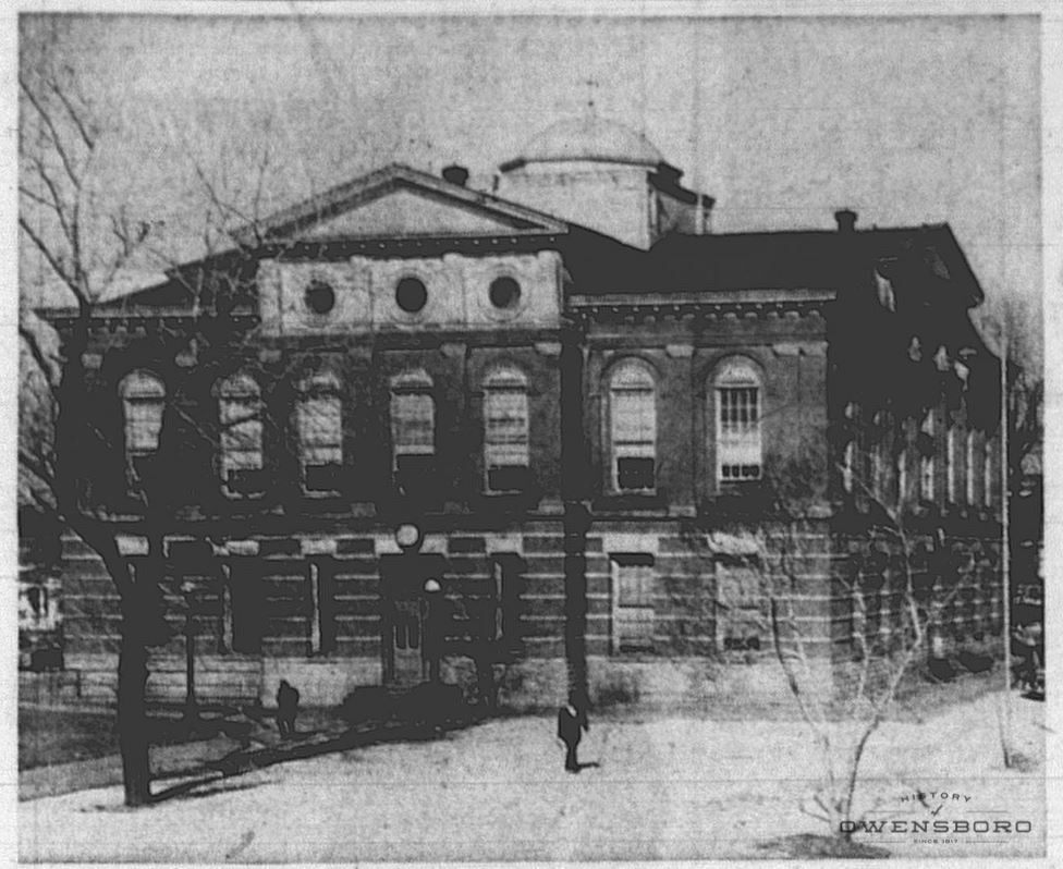
| 22:22, 29 September 2016 | DC Courthouse in Snow 2016.jpg (file) |  |
162 KB | Adam (talk | contribs) | Daviess County Courthouse in the snow, Jan 2016. | 1 |
| 22:10, 29 September 2016 | DC Courthouse in Winter.jpg (file) |  |
158 KB | Adam (talk | contribs) | Daviess County Courthouse in Winter - Early 2014 | 1 |
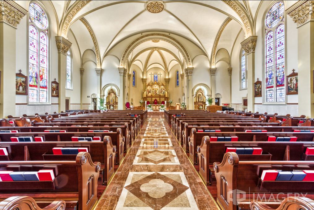
| 22:07, 29 September 2016 | St Stephens Interior.jpg (file) |  |
165 KB | Adam (talk | contribs) | Interior of St. Stephens Cathedral after the 2012 restoration. | 1 |
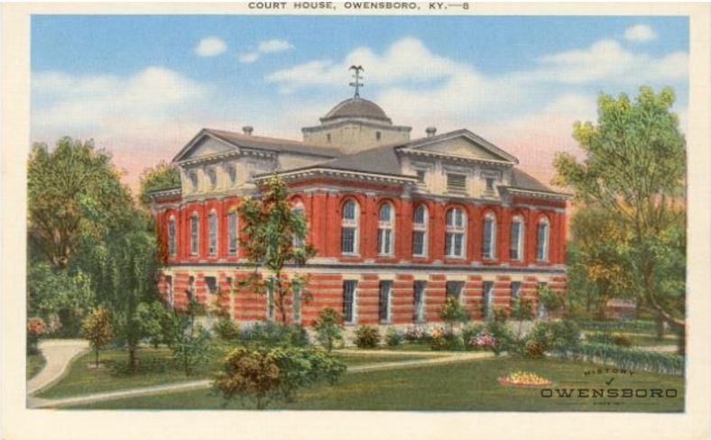
| 22:04, 29 September 2016 | DC Courthouse 2.jpg (file) |  |
134 KB | Adam (talk | contribs) | Daviess County Courthouse Postcard pre-1927 | 1 |
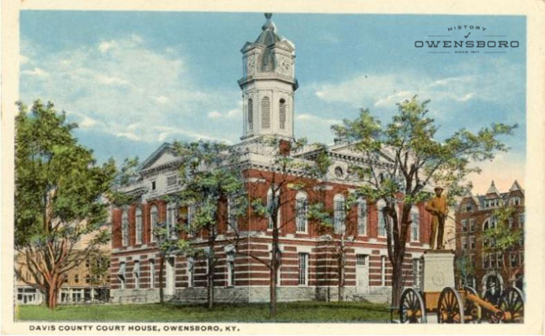
| 22:04, 29 September 2016 | DC Courthouse 1.jpg (file) |  |
118 KB | Adam (talk | contribs) | Daviess County Courthouse Postcard after 1927 | 1 |
| 22:03, 29 September 2016 | DC Courthouse 3.jpg (file) |  |
188 KB | Adam (talk | contribs) | Daviess County Courthouse around 1960 | 1 |
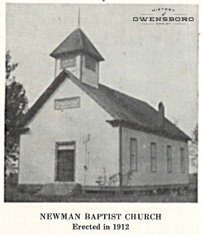
| 15:50, 29 September 2016 | Newman Baptist Church.jpg (file) |  |
113 KB | Adam (talk | contribs) | 1 | |
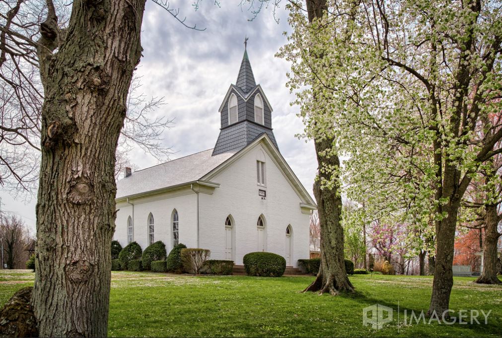
| 15:11, 28 September 2016 | BethabaraBaptistChurch2016.jpg (file) |  |
204 KB | Adam (talk | contribs) | Bethabara Baptist Church in March 2016. Photo by http://www.apimagery.com AP Imagery | 1 |
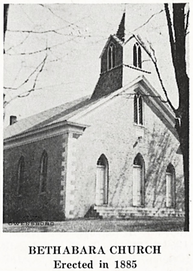
| 14:13, 28 September 2016 | BethabaraChurch.jpg (file) |  |
183 KB | Adam (talk | contribs) | Bethabara Baptist Church in Habit, KY | 1 |
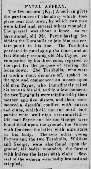
| 19:50, 26 September 2016 | PayneTurnbullArgument.jpg (file) |  |
65 KB | Adam (talk | contribs) | Article from The Plymouth Pilot. (Plymouth, Marshall County, Ind.) May 28, 1851 | 1 |
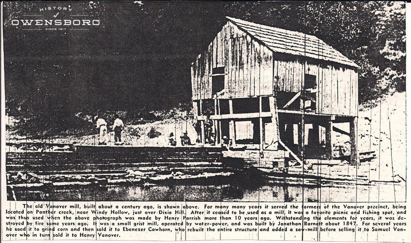
| 17:57, 26 September 2016 | VanoverMill.jpg (file) |  |
486 KB | Adam (talk | contribs) | Newspapaper article in the 1930's discussing Vanover Mill | 1 |
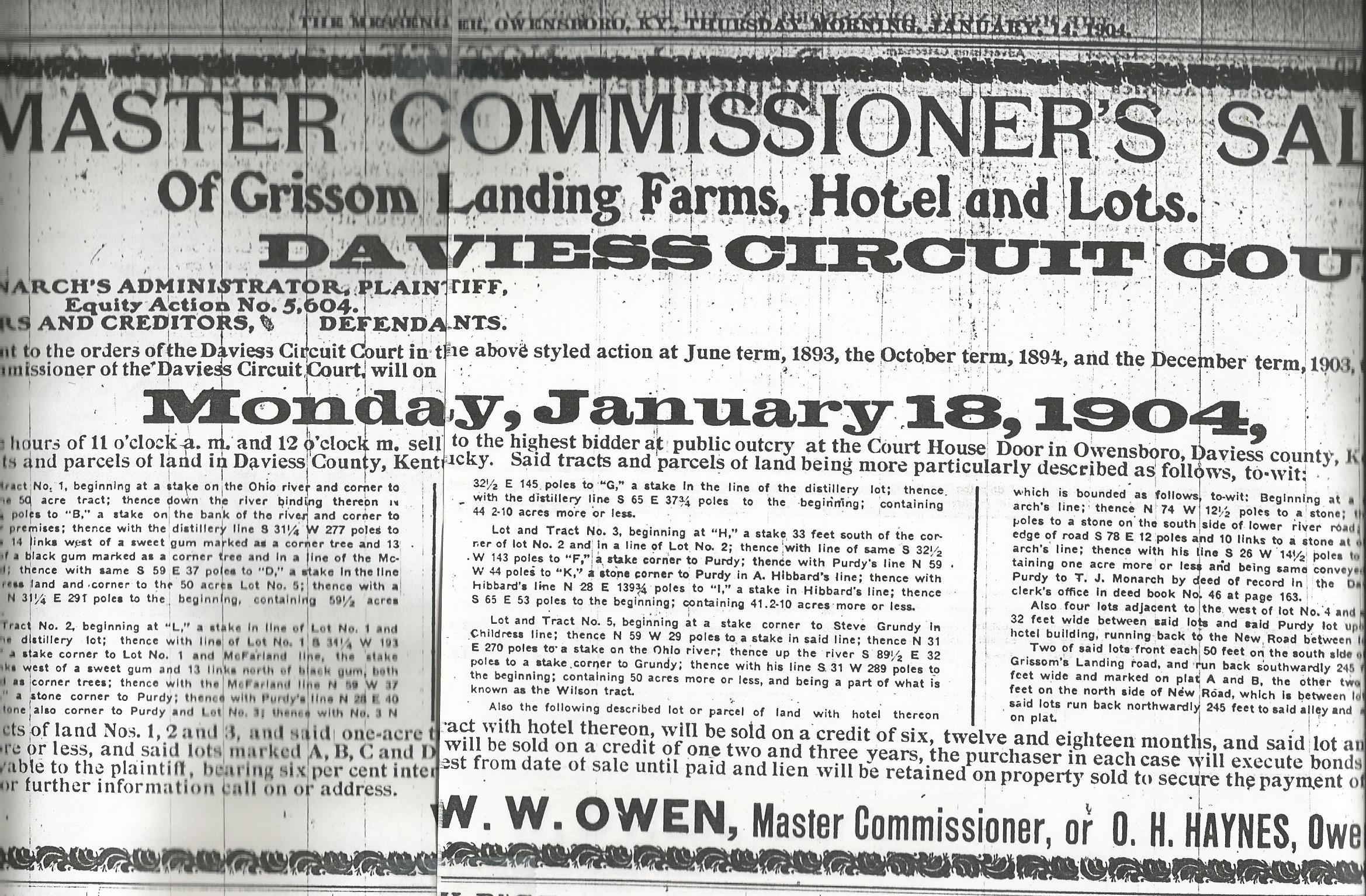
| 17:40, 26 September 2016 | Grissom Landing Sale.jpg (file) |  |
823 KB | Adam (talk | contribs) | The Messenger, Thursday Jan 24, 1904 - Land Sale at Grissom Landing | 1 |
| 12:33, 26 September 2016 | Knottsville Free Library.jpg (file) |  |
410 KB | Adam (talk | contribs) | Knottsville Free Public Library | 1 |
| 03:17, 26 September 2016 | Knottsville Free Public Library.jpg (file) |  |
201 KB | Adam (talk | contribs) | 1 | |
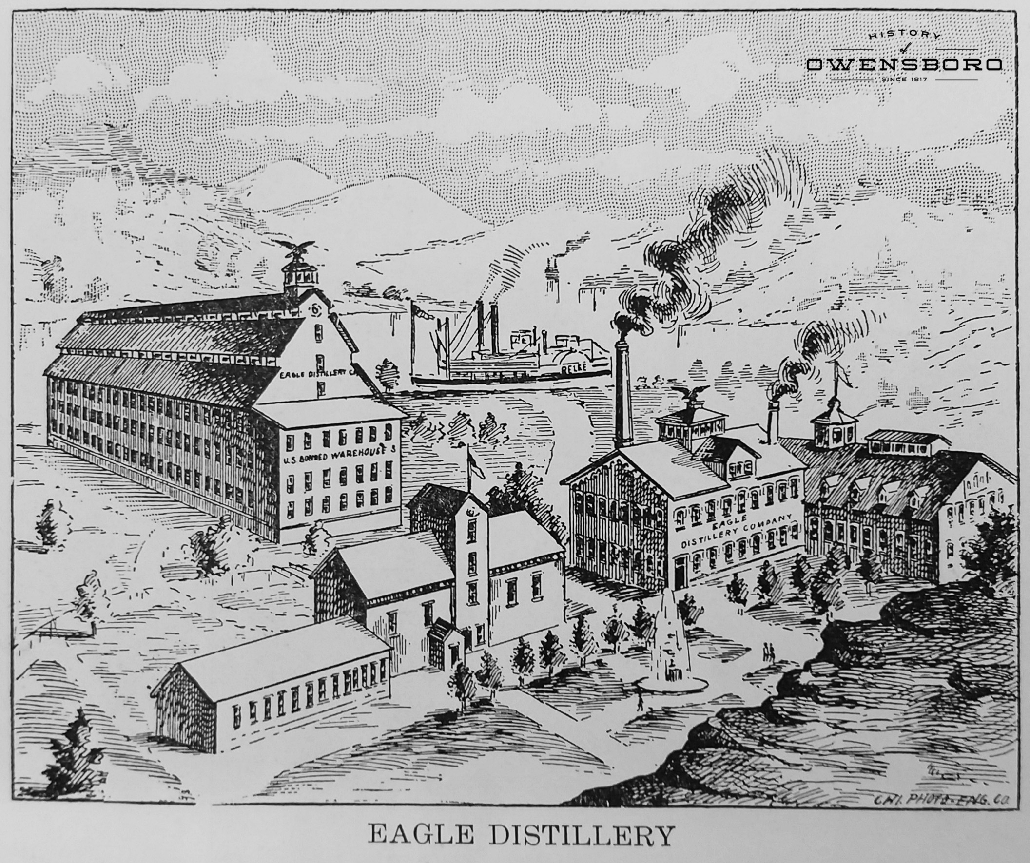
| 02:22, 26 September 2016 | Eagle Distillery Drawing.jpg (file) |  |
1.71 MB | Adam (talk | contribs) | 1 | |
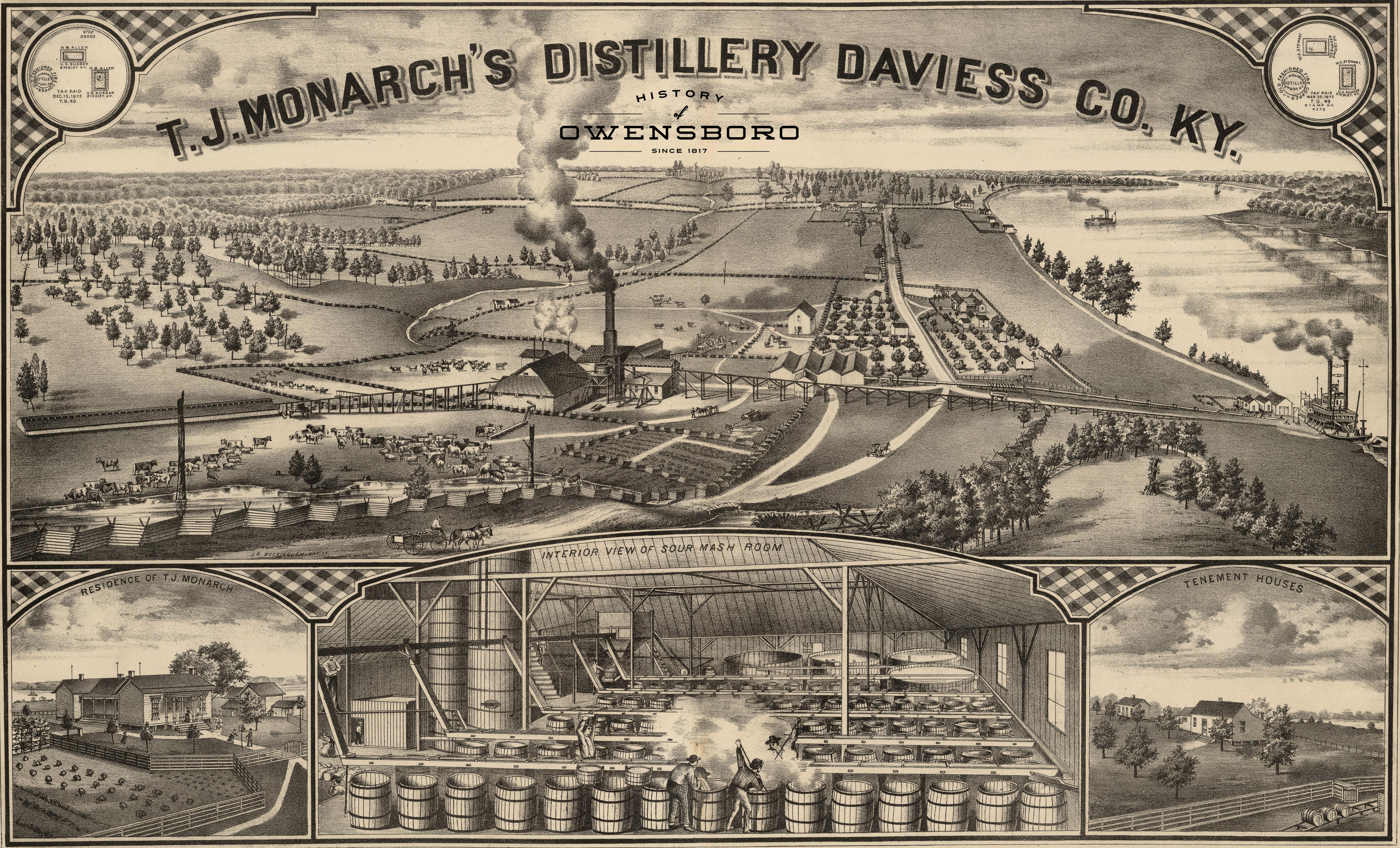
| 02:15, 26 September 2016 | Eagle Distillery 1876.jpg (file) |  |
19.46 MB | Adam (talk | contribs) | Rendition of Thomas J. Monarch's Eagle Distillery at Grissom's Landing | 1 |
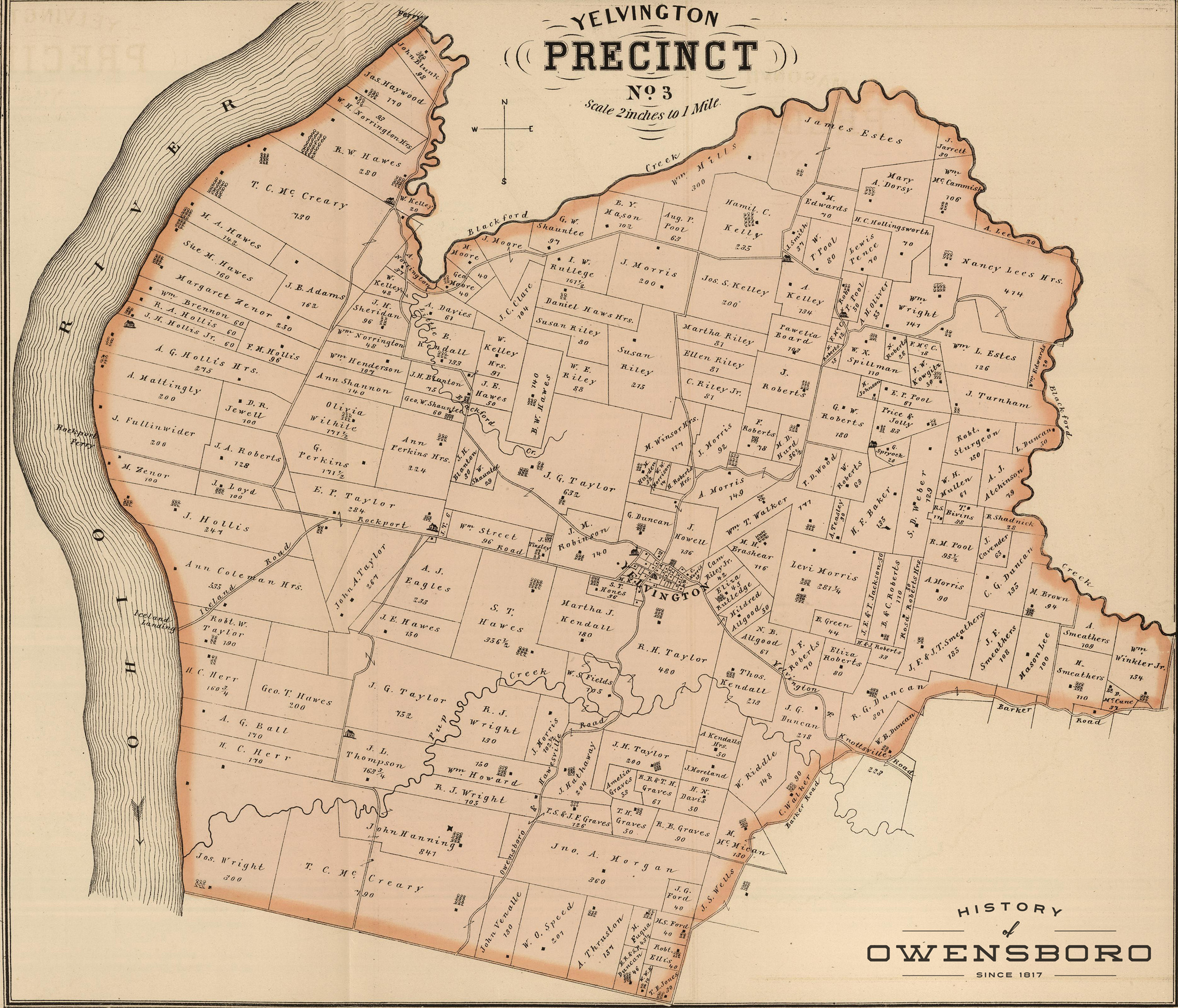
| 01:34, 18 September 2016 | Yelvington Precinct.jpg (file) |  |
1.82 MB | Adam (talk | contribs) | Map of Yelvington Precinct in 1876 | 1 |
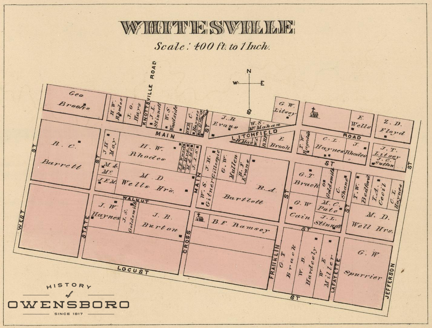
| 01:34, 18 September 2016 | Whitesville Map - 1876.jpg (file) |  |
428 KB | Adam (talk | contribs) | Detail Map of Whitesville in 1876 | 1 |
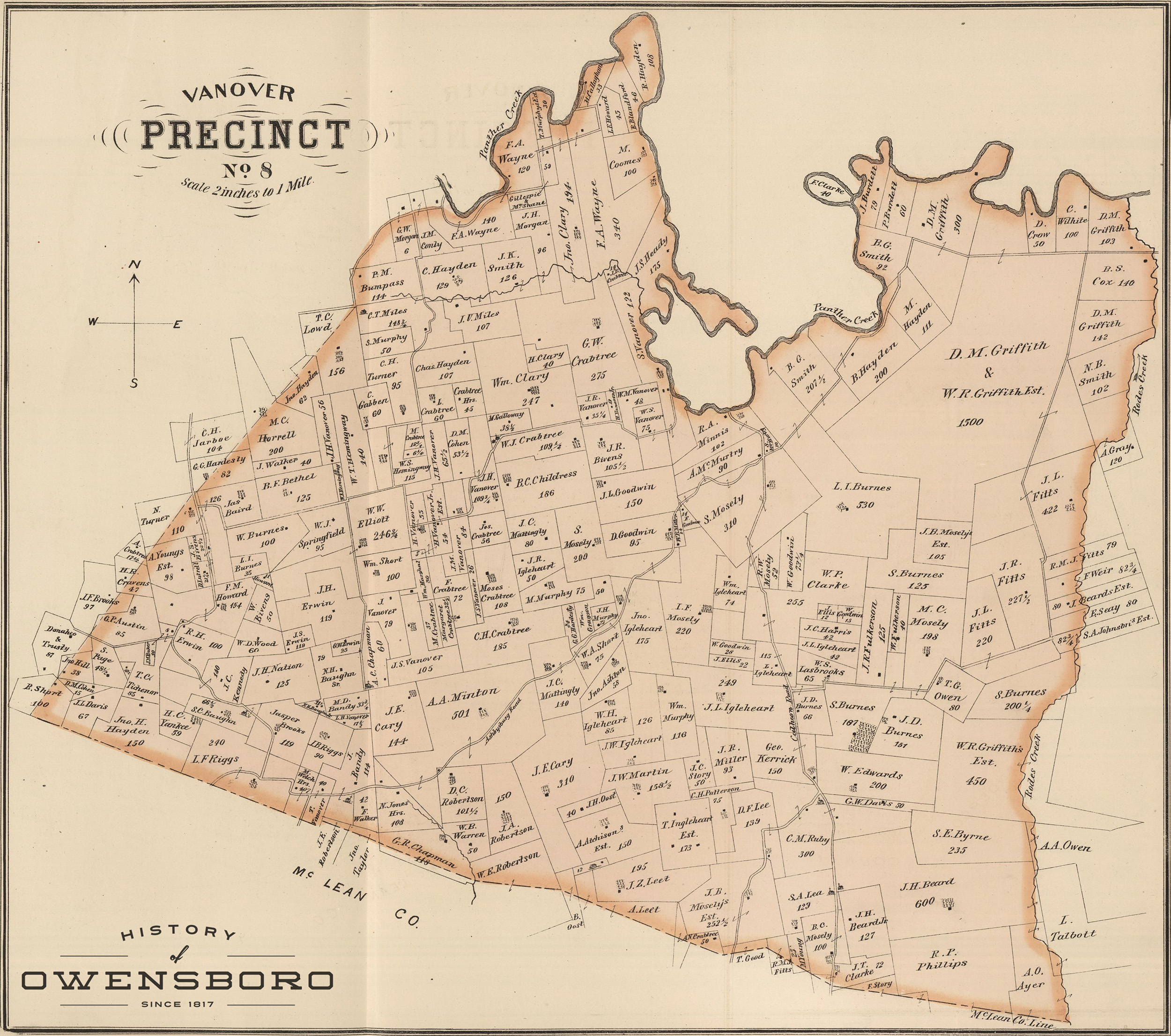
| 01:33, 18 September 2016 | Vanover Precinct.jpg (file) |  |
1.63 MB | Adam (talk | contribs) | Map of Vanover Precinct in 1876 | 1 |
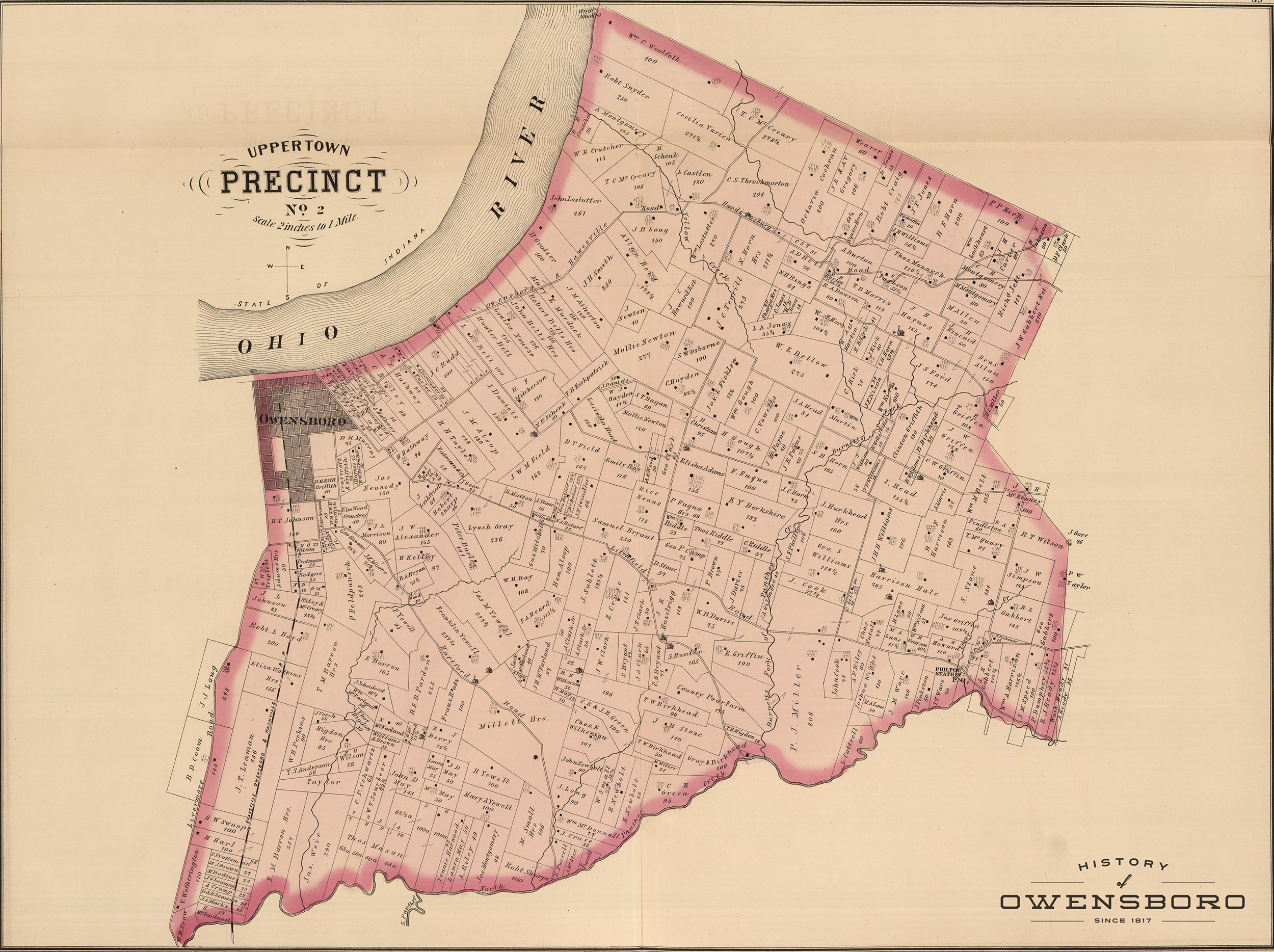
| 01:33, 18 September 2016 | Upper Town Precinct.jpg (file) |  |
1.45 MB | Adam (talk | contribs) | Map of Upper Town Precinct in 1876 | 1 |
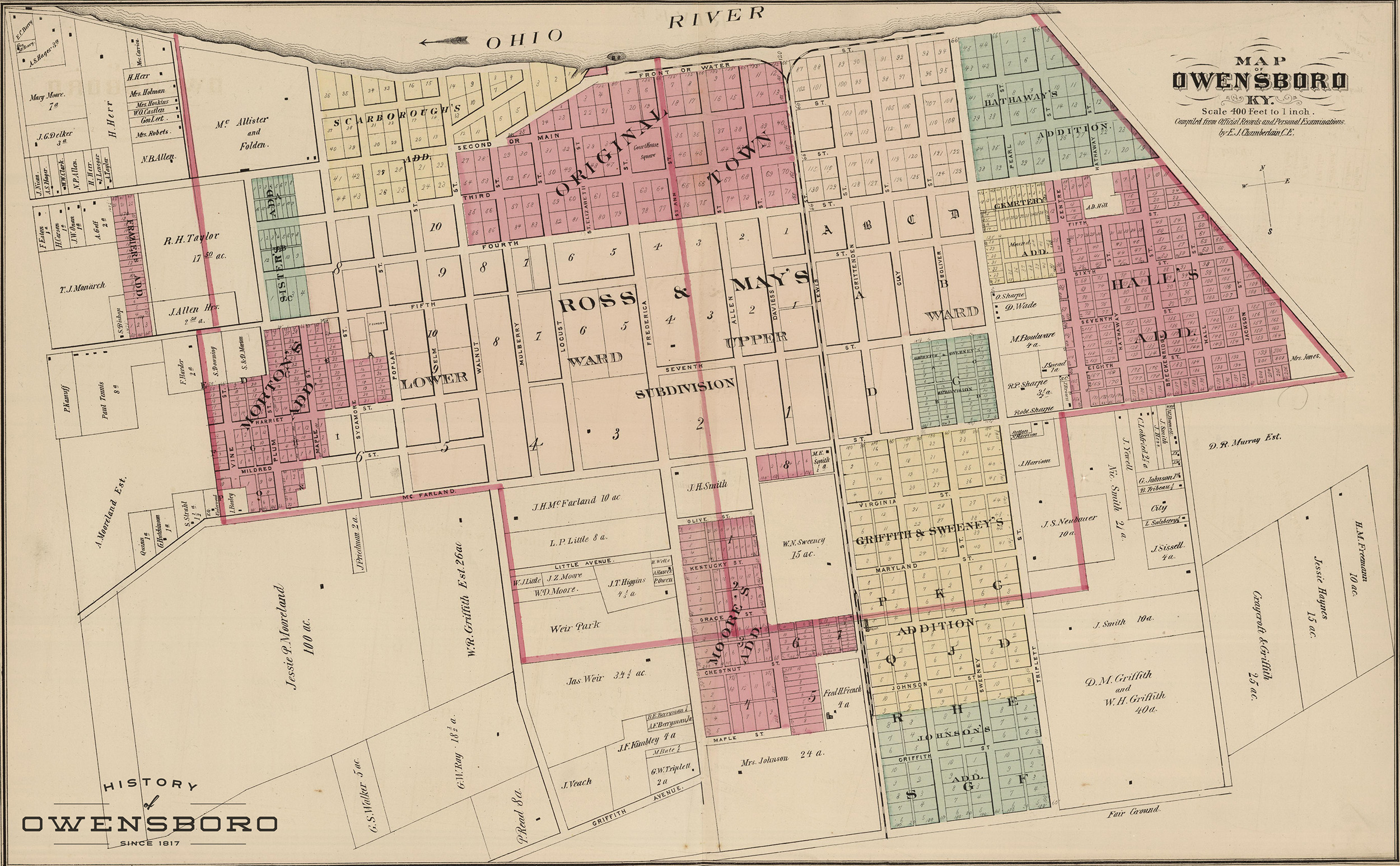
| 01:32, 18 September 2016 | Owensboro Map - 1876.jpg (file) |  |
1.3 MB | Adam (talk | contribs) | Detail Map of Owensboro in 1876 | 1 |
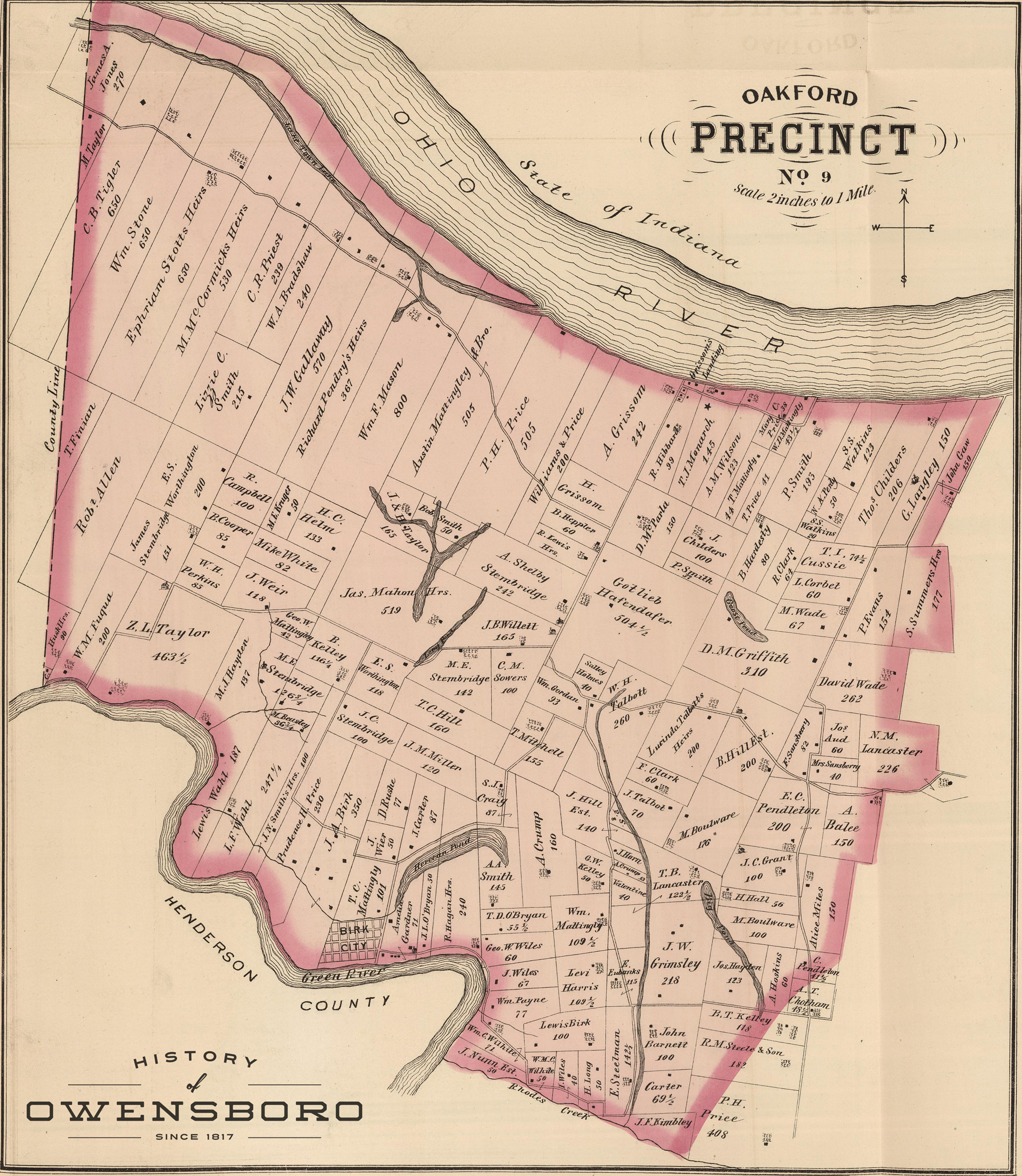
| 01:32, 18 September 2016 | Oakford Precinct.jpg (file) |  |
1.78 MB | Adam (talk | contribs) | Map of Oakford Precinct in 1876 | 1 |
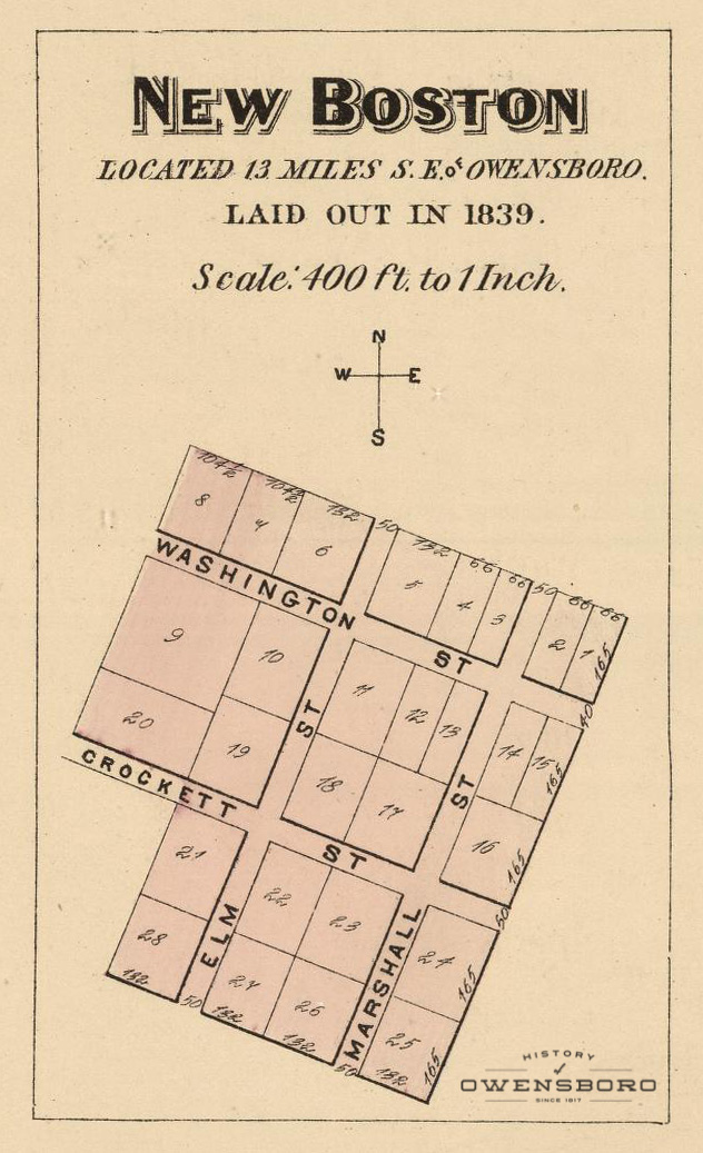
| 01:32, 18 September 2016 | New Boston Map - 1876.jpg (file) |  |
233 KB | Adam (talk | contribs) | Detail map of New Boston in 1876 | 1 |
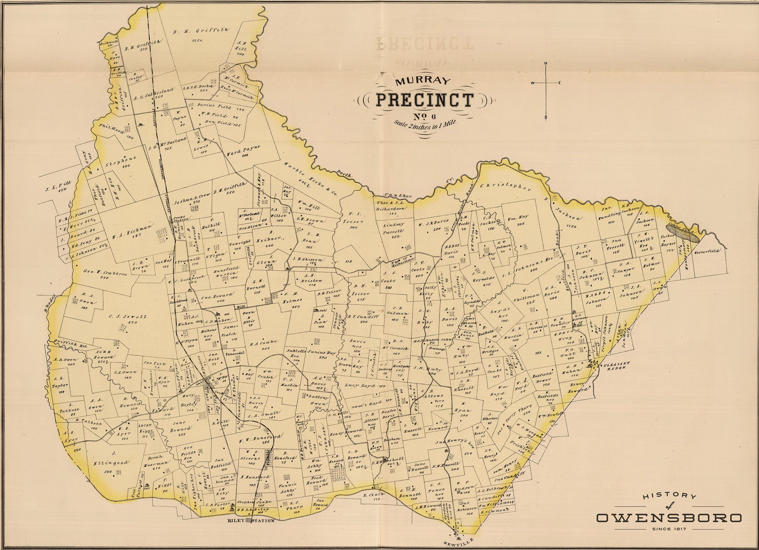
| 01:27, 18 September 2016 | Murray Precinct.jpg (file) |  |
1.38 MB | Adam (talk | contribs) | Map of Murray Precinct in 1876 | 1 |
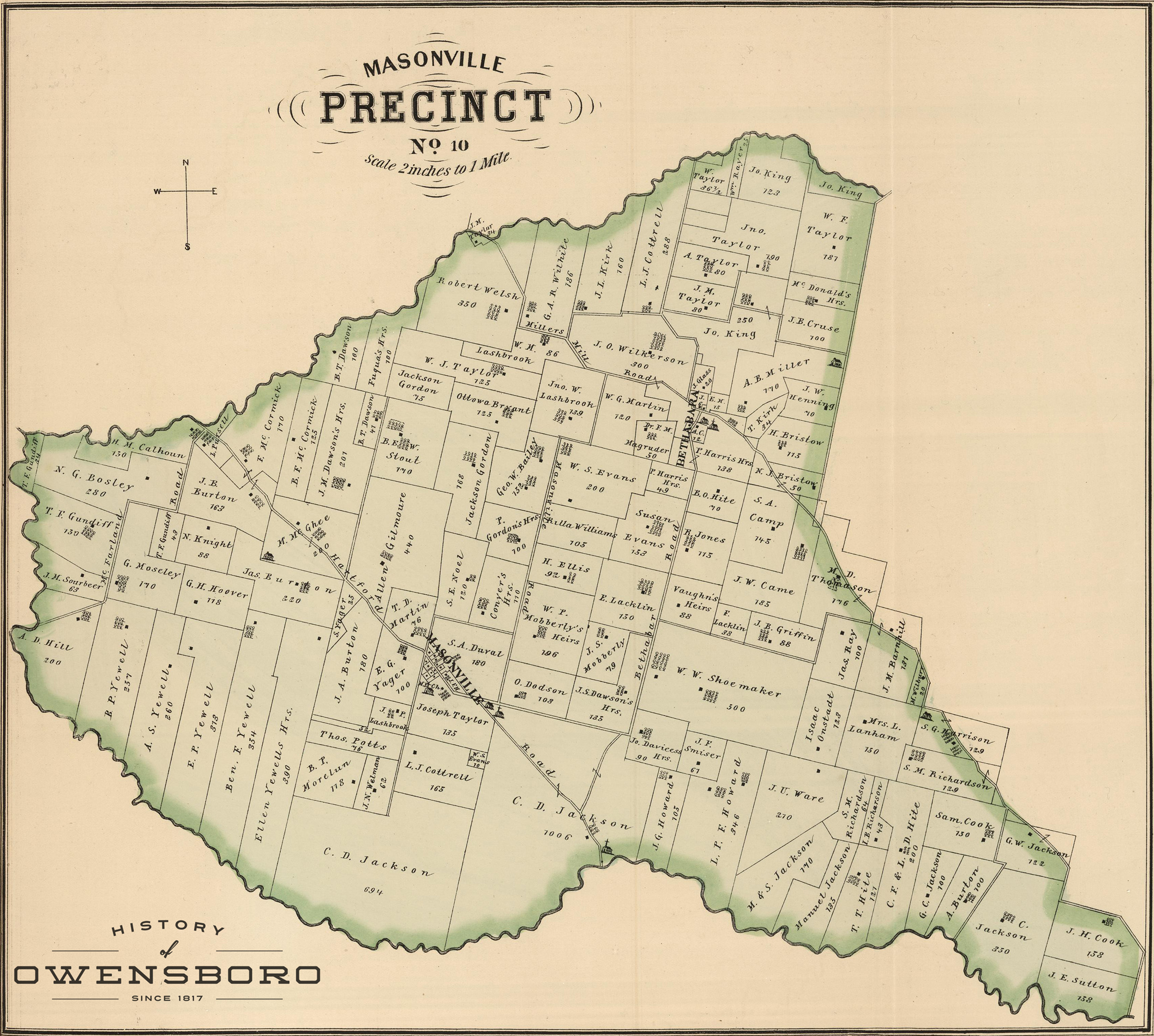
| 01:27, 18 September 2016 | Masonville Precinct.jpg (file) |  |
1.48 MB | Adam (talk | contribs) | Map of Masonville Precinct in 1876 | 1 |
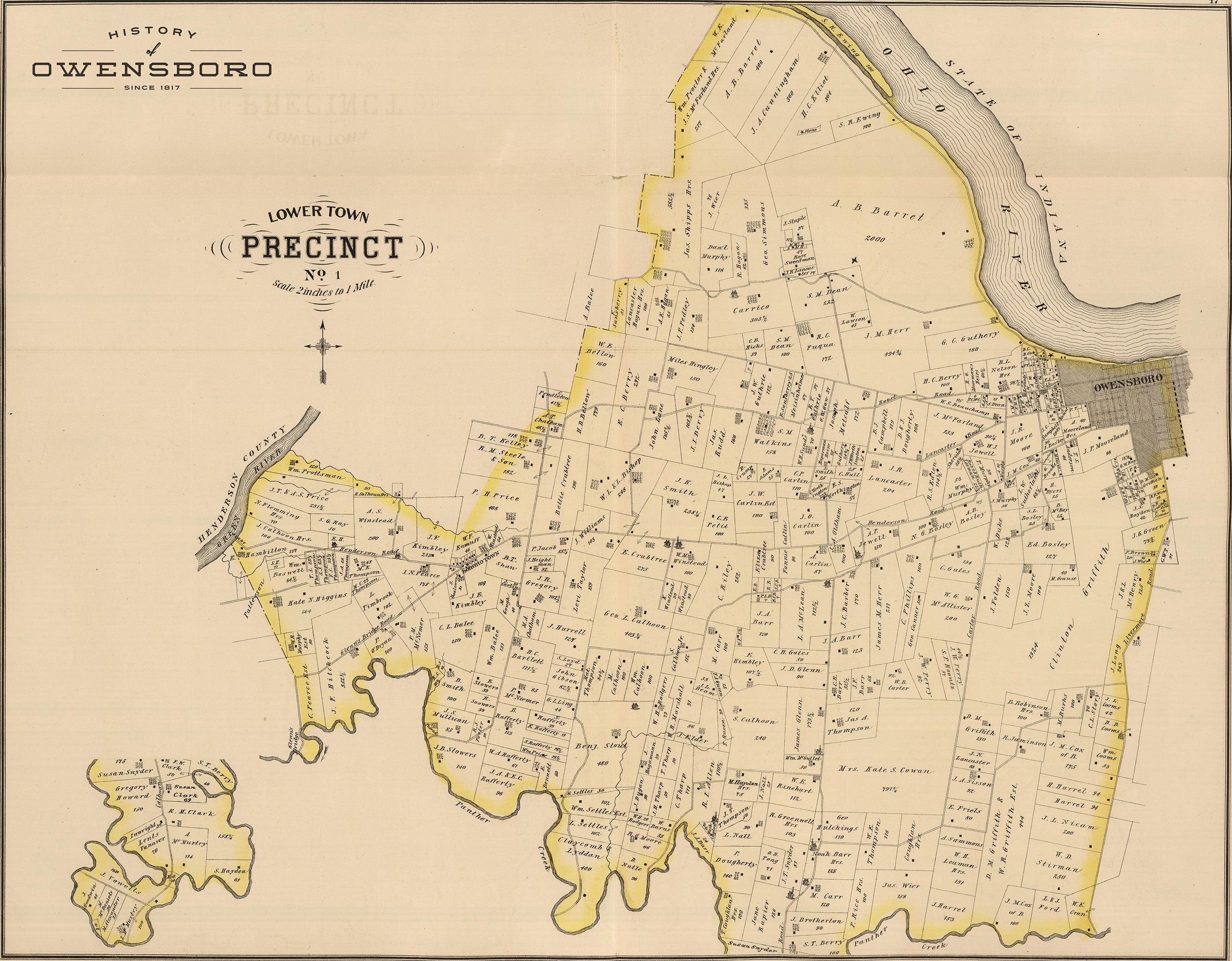
| 01:26, 18 September 2016 | Lower Town Precinct.jpg (file) |  |
1.46 MB | Adam (talk | contribs) | Map of Lower Town Precinct in 1876 | 1 |
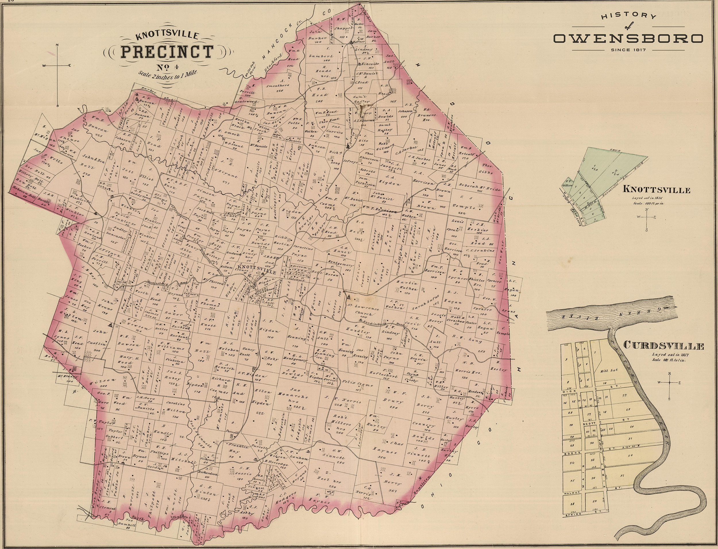
| 01:26, 18 September 2016 | Knottsville Precinct.jpg (file) |  |
1.6 MB | Adam (talk | contribs) | Map of Knottsville Precinct in 1876 | 1 |
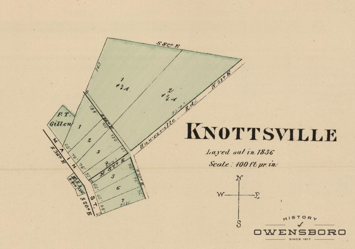
| 01:25, 18 September 2016 | Knottsville Map - 1876.jpg (file) |  |
178 KB | Adam (talk | contribs) | Detail Map of Knottsville in 1876 | 1 |
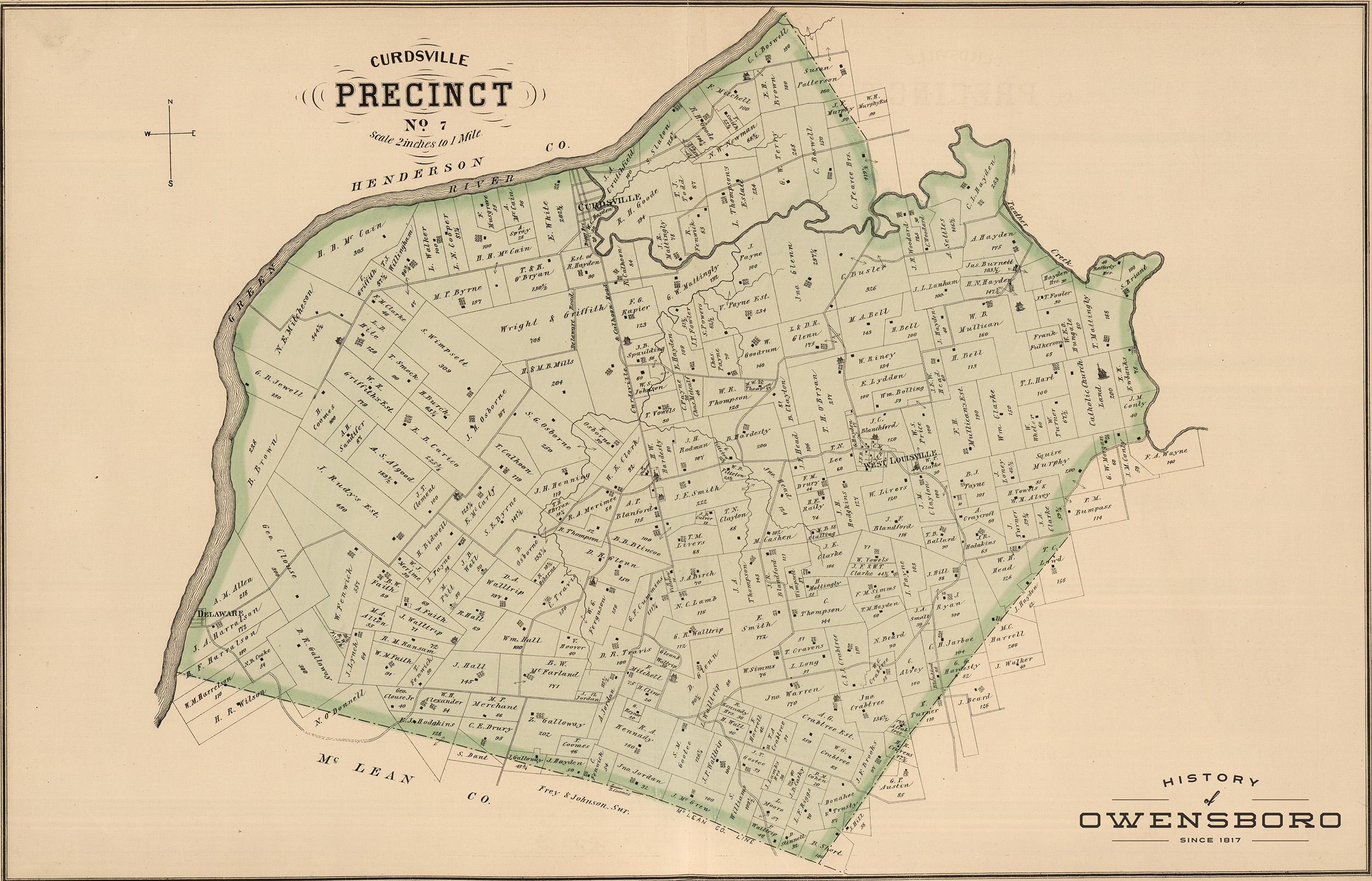
| 01:25, 18 September 2016 | Curdsville Precinct.jpg (file) |  |
1.19 MB | Adam (talk | contribs) | Map of Curdsville Precinct in 1876 | 1 |
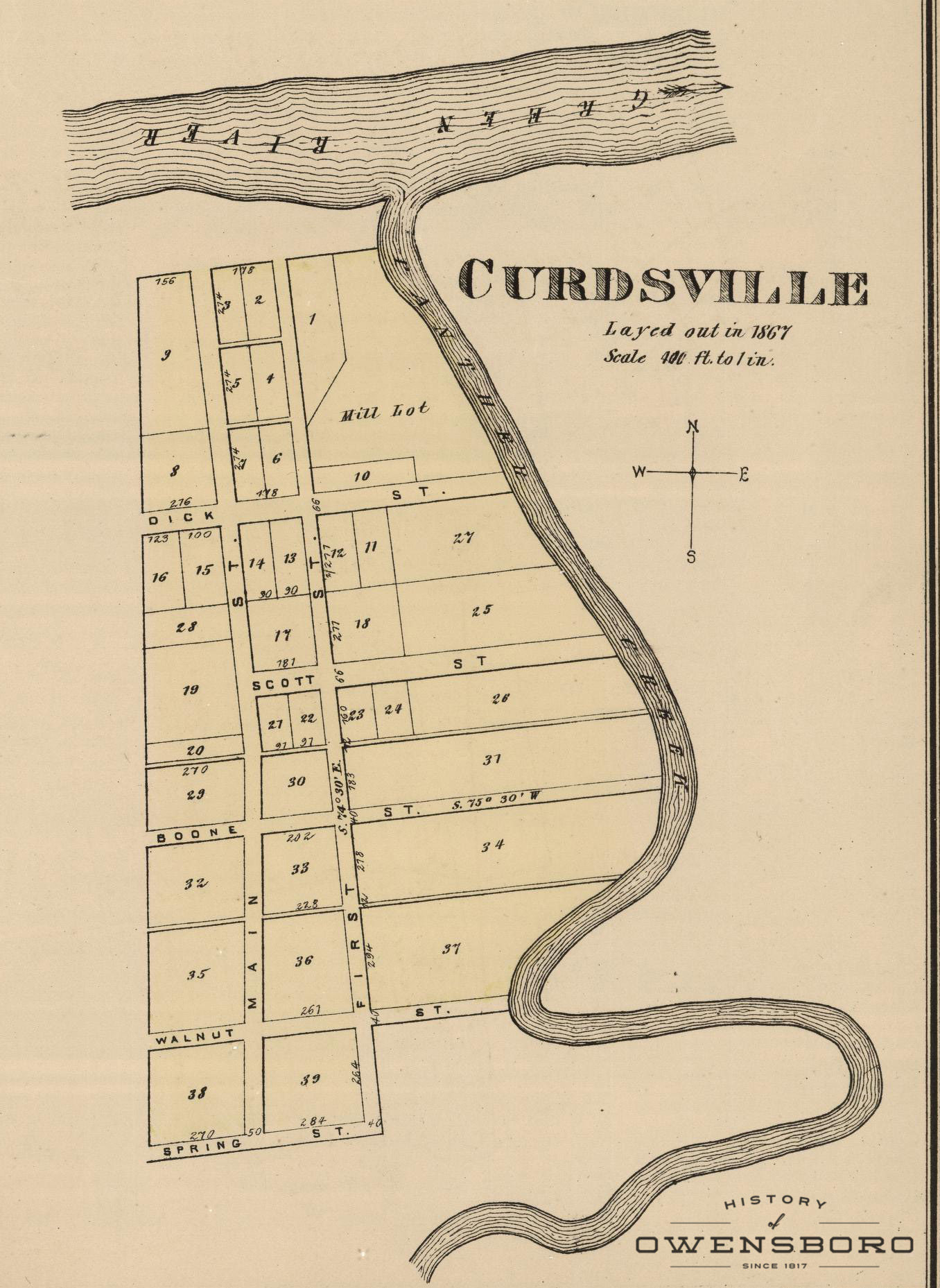
| 01:24, 18 September 2016 | Curdsville Map - 1876.jpg (file) |  |
547 KB | Adam (talk | contribs) | Detail Map of Curdsville in 1876 | 1 |
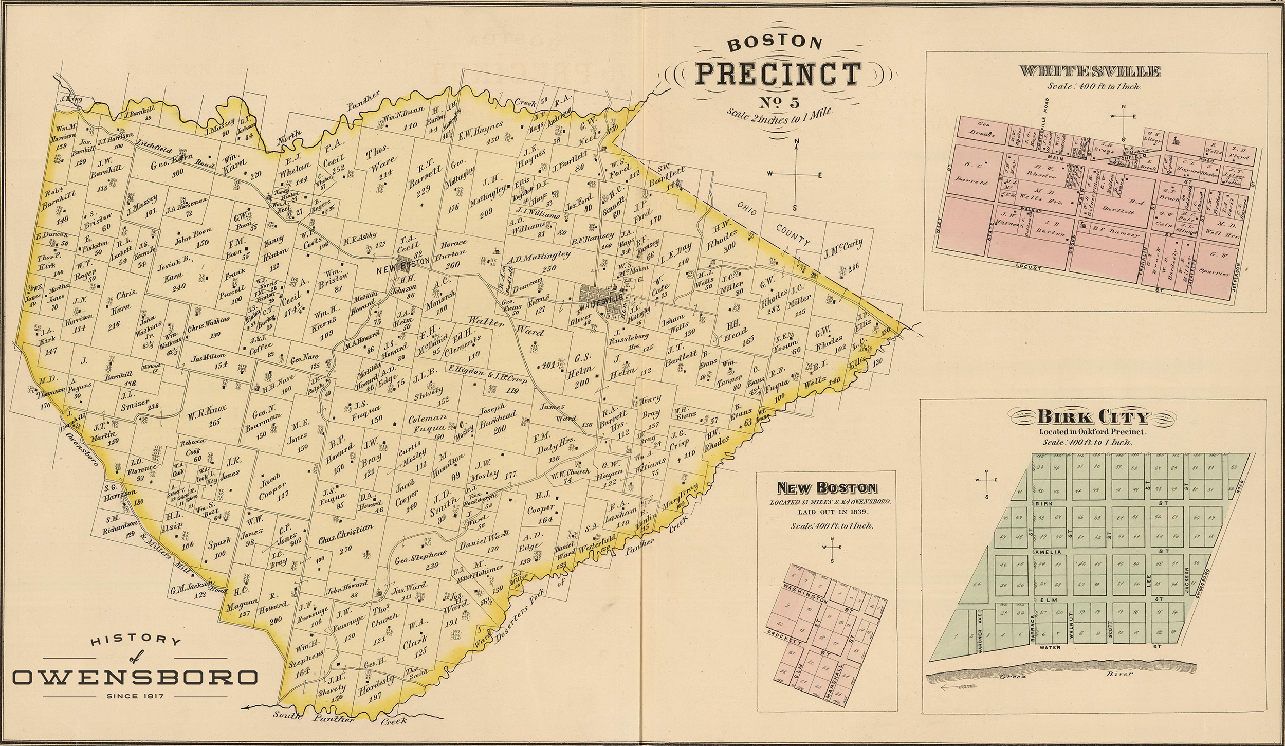
| 01:23, 18 September 2016 | Boston Precinct.jpg (file) |  |
1.28 MB | Adam (talk | contribs) | Map of Boston Precinct in 1876 | 1 |
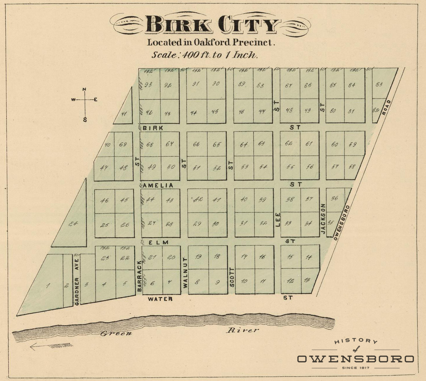
| 01:23, 18 September 2016 | Birk City Map - 1876.jpg (file) |  |
481 KB | Adam (talk | contribs) | Detail Map of Birk City in 1876 | 1 |
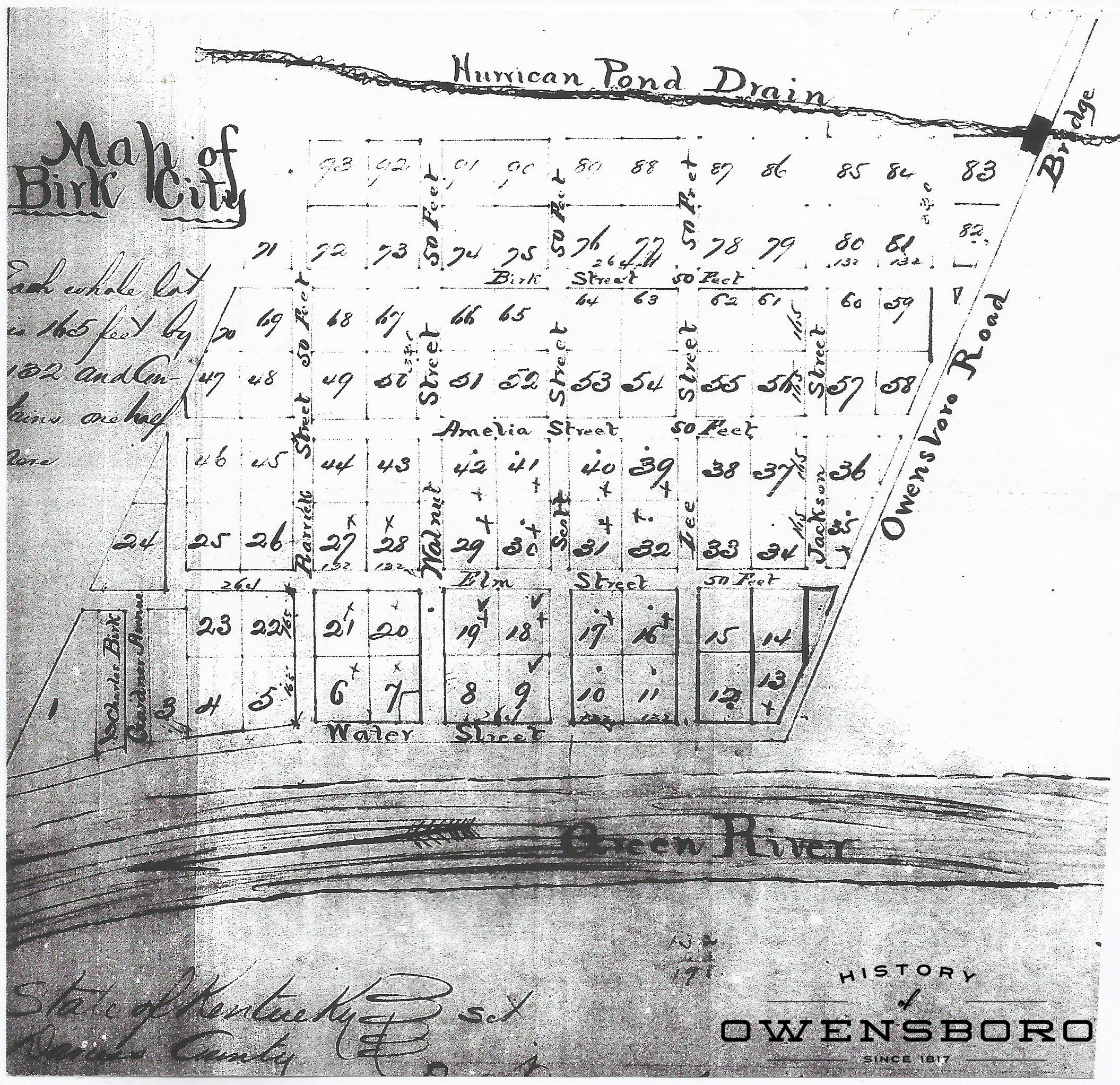
| 14:23, 15 September 2016 | Plots in Birk City 1860.jpg (file) |  |
1.72 MB | Adam (talk | contribs) | Survey of Plots in Birk City, 1860 | 1 |
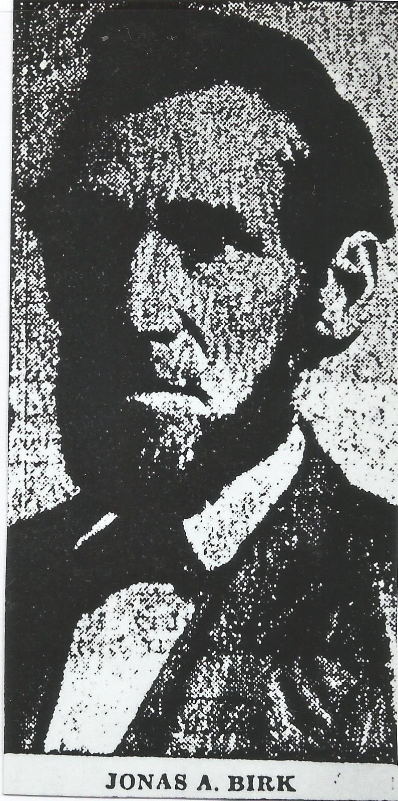
| 13:30, 15 September 2016 | Jonas Birk.jpg (file) |  |
299 KB | Adam (talk | contribs) | Found of Birk City. | 1 |
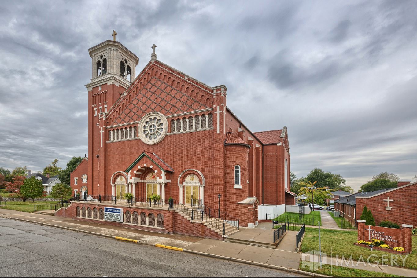
| 04:54, 15 September 2016 | St Stephens - 2015.jpg (file) |  |
225 KB | Adam (talk | contribs) | St. Stephen Cathedral - Current Building. Photo by: AP Imagery | 1 |
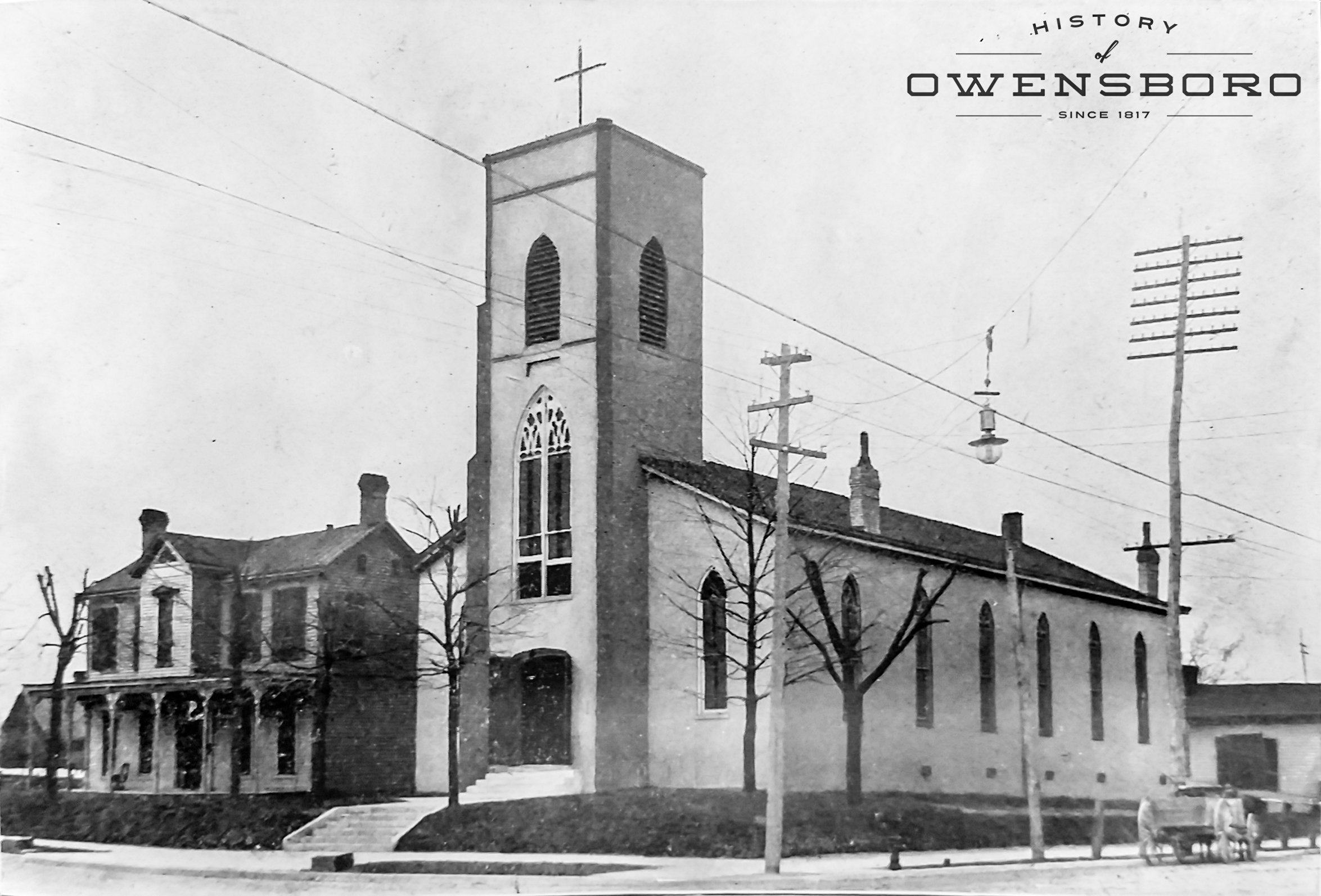
| 04:41, 15 September 2016 | St Stephen Catholic Church - Early 1900s.jpg (file) |  |
1.22 MB | Adam (talk | contribs) | St Stephen Catholic Church in the Early 1900's. It faced west and was located on the SW corner of Main (2nd) and Mulberry (Cedar). | 1 |
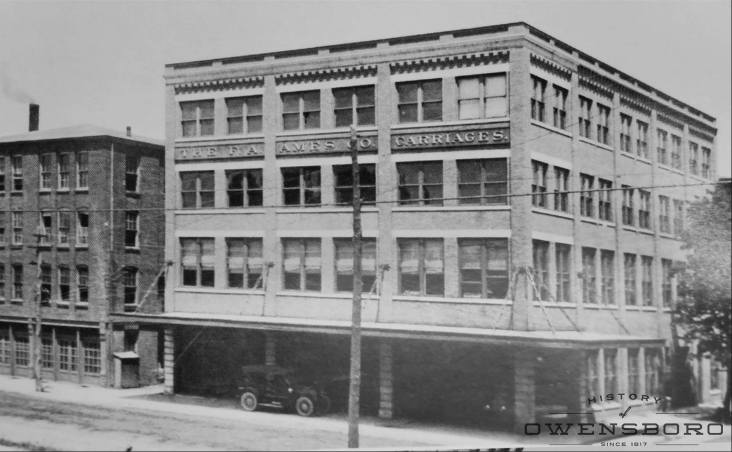
| 03:06, 13 September 2016 | Ames Buddy Co.jpg (file) |  |
306 KB | Adam (talk | contribs) | The F. A. Ames Buddy Company building on the northeast corner of W. 3rd Street and St. Elizabeth Street. | 1 |
| 21:38, 10 September 2016 | 1876 - Daviess County Precinct Index map.jpg (file) |  |
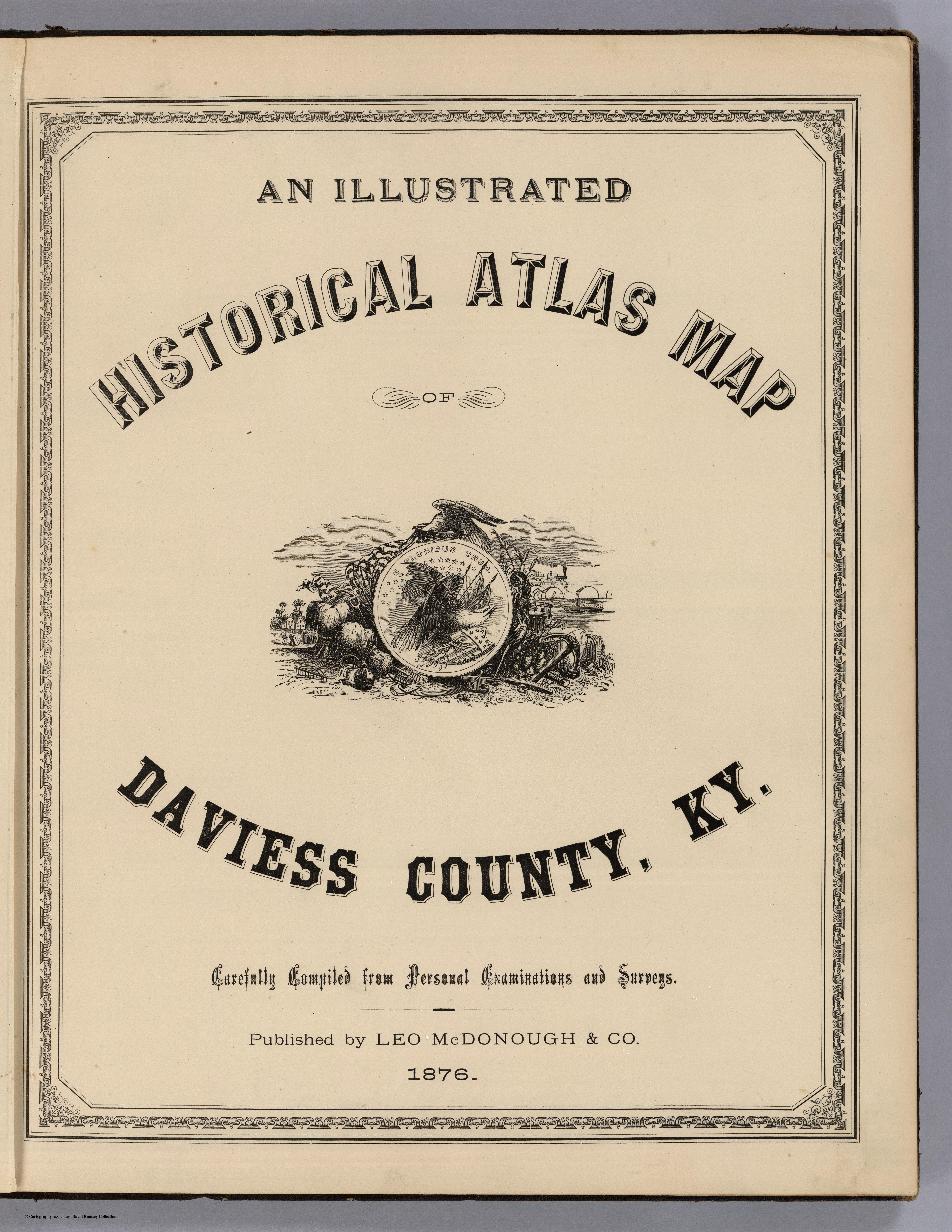
5.08 MB | Adam (talk | contribs) | This 1876 map of Daviess County, KY shows precincts, locations of towns, post offices, railroads, wagon roads, churches, school houses, etc. Map drawn by E. J. Chamberlain, C. E. Precincts are: Oakford, Curdsville, Lower Town, Upper Town, Vanover, Mur... | 1 |
| 20:36, 10 September 2016 | 3389002.jpg (file) |  |
5.65 MB | Adam (talk | contribs) | 1 |