
File:Whitesville Map - 1876.jpg
File on History of Owensboro
More actions
Size of this preview: 789 × 599 pixels. Other resolution: 1,427 × 1,084 pixels.
Original file (1,427 × 1,084 pixels, file size: 428 KB, MIME type: image/jpeg)
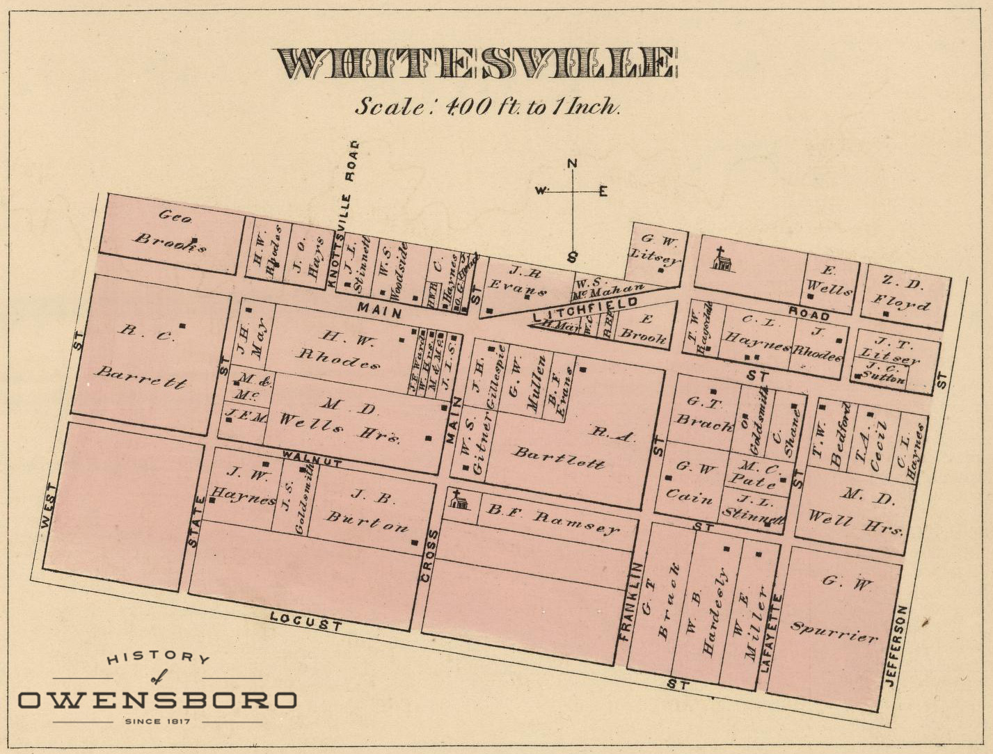
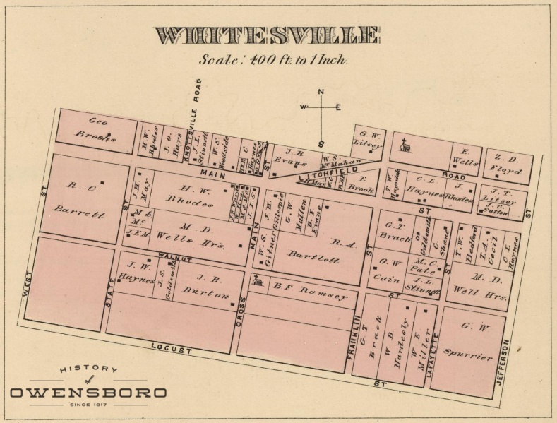
Detail Map of Whitesville in 1876
File history
Click on a date/time to view the file as it appeared at that time.
| Date/Time | Thumbnail | Dimensions | User | Comment | |
|---|---|---|---|---|---|
| current | 01:34, 18 September 2016 | | 1,427 × 1,084 (428 KB) | Adam (talk | contribs) | Detail Map of Whitesville in 1876 |
You cannot overwrite this file.
File usage
There are no pages that use this file.